Why Ushuaia Is Like No Other Destination on Earth
Ushuaia is not simply the southernmost permanently inhabited city in the world — although that alone would be enough to justify the trip. It is a place where geography, history and wildlife intersect in a way that has no equivalent anywhere else on the planet. To understand why, you need to know how it is put together.
The city sits on the northern shore of the Beagle Channel, the waterway Charles Darwin sailed in 1833 aboard the HMS Beagle during its second expedition around the world. The channel is about 240 kilometers long and separates the main island of Tierra del Fuego from an archipelago of smaller islands to the south. What makes it unique is its formation: the Andes, which run the length of South America from north to south for thousands of kilometers, reach Tierra del Fuego and, instead of ending in a plain, plunge straight into the sea. The result is a coastline of mountains dropping abruptly into the water, with glaciers hanging between snow-capped peaks and spilling into fjords of dark, deep waters.
This geographic accident has enormous biological consequences. The cold, nutrient-rich waters of the Beagle Channel are the natural habitat of South American fur seals (Arctocephalus australis), imperial cormorants (Leucocarbo atriceps), Magellanic penguins (Spheniscus magellanicus) and a variety of sub-Antarctic seabirds that cannot be seen anywhere else in mainland Argentina. On land, the sub-Antarctic forest of lenga (Nothofagus pumilio) and ñire (Nothofagus antarctica) covers the slopes of the Fuegian Andes with a look that recalls the landscapes of Chilean Patagonia or even New Zealand more than what most people imagine when they think of Argentina.
Ushuaia's human history is equally extraordinary. The Yagan people — also known as the Yámana — inhabited this region for at least 8,000 years, adapting to one of the harshest climates on the planet with a resilience that still astonishes anthropologists. They lived in canoes, slept in huts open to the wind and coated themselves with animal fat to protect against the cold, without clothing in the modern sense. When Darwin saw them during the voyage of the Beagle, he described them with a mixture of amazement and the condescension typical of his era. The European colonization that followed was, as in almost all of the Americas, devastating for the native peoples.
The city founded at the end of the 19th century began as a penal colony: in 1896 Argentina established the Ushuaia Recidivists' Prison — today the Maritime Museum — to confine political prisoners and common criminals in the most remote corner of the country. That history of confinement was etched into the city's identity, which today wears it with pride and has turned it into one of its most visited attractions.
All of this — the extreme geography, the sub-Antarctic wildlife, the history of Darwin's channel, the prison at the end of the world and the only National Park in Argentina with a sea coast — is what makes Ushuaia a destination with no substitute. It is not the "mini Torres del Paine" or the "easiest glacier to reach." It is its own world, with its own logic and its own rhythm.
Ushuaia sits at 54°48' south latitude. For reference: that is farther south than the southernmost tip of New Zealand, farther south than any city in Europe, and only 1,200 km from the closest point of Antarctica. December and January nights last barely 4 hours. In June, the sun does not rise until 10 in the morning.
Beagle Channel Navigation — Sea Lions, Cormorants and the Lighthouse at the End of the World
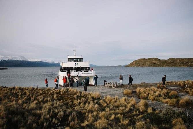
If there is one single activity that sums up the essence of Ushuaia, it is the Beagle Channel navigation. Not because it is the most spectacular in visual terms — although it is — but because it is the most direct way to connect with the landscape that gave rise to everything: the water Darwin crossed, the islands where thousands of animals gather and the lighthouse that for decades marked the world's southernmost navigable passage.
The history of the HMS Beagle in these waters
The channel bears the ship's name because it was the HMS Beagle, under Captain Robert FitzRoy, that first charted it accurately on its first expedition (1826-1830). On the second expedition (1831-1836), a 22-year-old naturalist named Charles Darwin was on board, and he spent several months in Tierra del Fuego studying the flora, the fauna and, above all, the Yagan inhabitants of the channel. What Darwin observed in these waters — the extreme adaptation of the Yagan to the cold, the diversity of marine life, landscapes where natural selection was visible to the naked eye — contributed directly to the development of the ideas he would publish twenty-three years later in On the Origin of Species (1859).
Sailing today the same channel the Beagle traveled has something of a journey through time. The water has not changed. Neither have the islands. The sea lions still pile up on the same rocky outcrops. And the lighthouse visited today — the Les Éclaireurs Lighthouse — is still lit, although it is no longer needed the way it was for more than a century of southern navigation.
What you will see during the navigation
The standard 3-hour circuit covers three specific points, each with its own appeal:
Isla de los Pájaros (Bird Island): a low, stony island that is the permanent nesting site of imperial cormorants (Leucocarbo atriceps). This species exists only in the region of the Beagle Channel and the Drake Sea: you will not see it anywhere else in the world. Imperial cormorants have sharply contrasting black-and-white plumage, with an orange caruncle above the bill. The colony on Isla de los Pájaros can have several hundred nesting individuals, and the constant noise and movement of the colony is one of those natural spectacles remembered long afterward.
Isla de los Lobos (Sea Lion Island): the channel's best-known rocky outcrop, where a permanent colony of South American fur seals (Arctocephalus australis) rests, fights, mates and raises its pups. The fur seal is distinguished from the common sea lion by its denser coat (hence the Spanish name "two-fur sea wolf") and by being significantly smaller than the one-fur sea lion (Otaria flavescens). Dominant males weigh between 150 and 200 kg and organize harems of up to 15 females during the breeding season (November-January). The smell from a distance announces them before you see them.
Les Éclaireurs Lighthouse: the red-and-white lighthouse built in 1920 on a small rocky island is perhaps the most photographed image of Ushuaia. Its name comes from the French ship L'Éclaireur (the scout), which was wrecked nearby. Although many tourists call it "the lighthouse at the end of the world" — confusing it with the San Juan de Salvamento Lighthouse on Isla de los Estados, which inspired Jules Verne's novel — it is just as powerful as an image: an 11-meter tower on a rock in the middle of the world's southernmost channel, with the snow-capped Andes in the background.
AM vs PM departure: which one is better?
The 10:00 AM departure has the advantage of leaving the afternoon free for another activity — many travelers combine the morning navigation with the afternoon excursion to Tierra del Fuego National Park, both on the same day, which is perfectly workable in terms of schedules. The morning light in summer can be intense, which improves photos of the animals but can create glare on the water.
The 3:00 PM departure offers afternoon light, which in summer is golden and spectacular over the snow-capped Andes and the dark water of the channel. In winter, that same hour has a low, bluish light that gives photos an almost unreal quality. Those who prioritize photography usually prefer the PM departure. The downside is that if bad weather rolls in during the afternoon, it can be more affected by the evening wind.
⚠️ Important: The Beagle Channel excursion does NOT include hotel pick-up. You must arrive at the port of Ushuaia 30 minutes in advance. The port is a short distance from the city center. The port boarding fee IS included in the price.
Isla de los Pájaros · Isla de los Lobos · Les Éclaireurs Lighthouse. Pick-up NOT included — arrive at the port 30 min early. Suitable for all ages.
Tierra del Fuego National Park — The End of Route 3
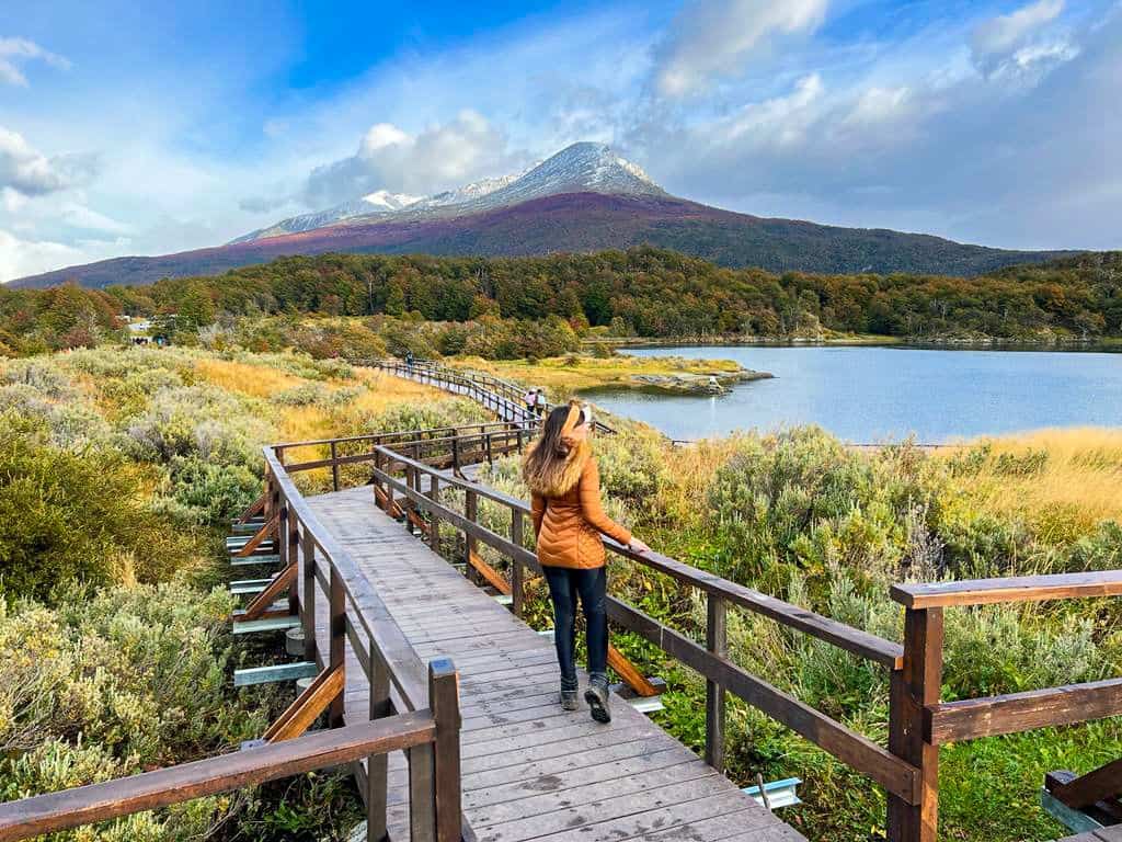
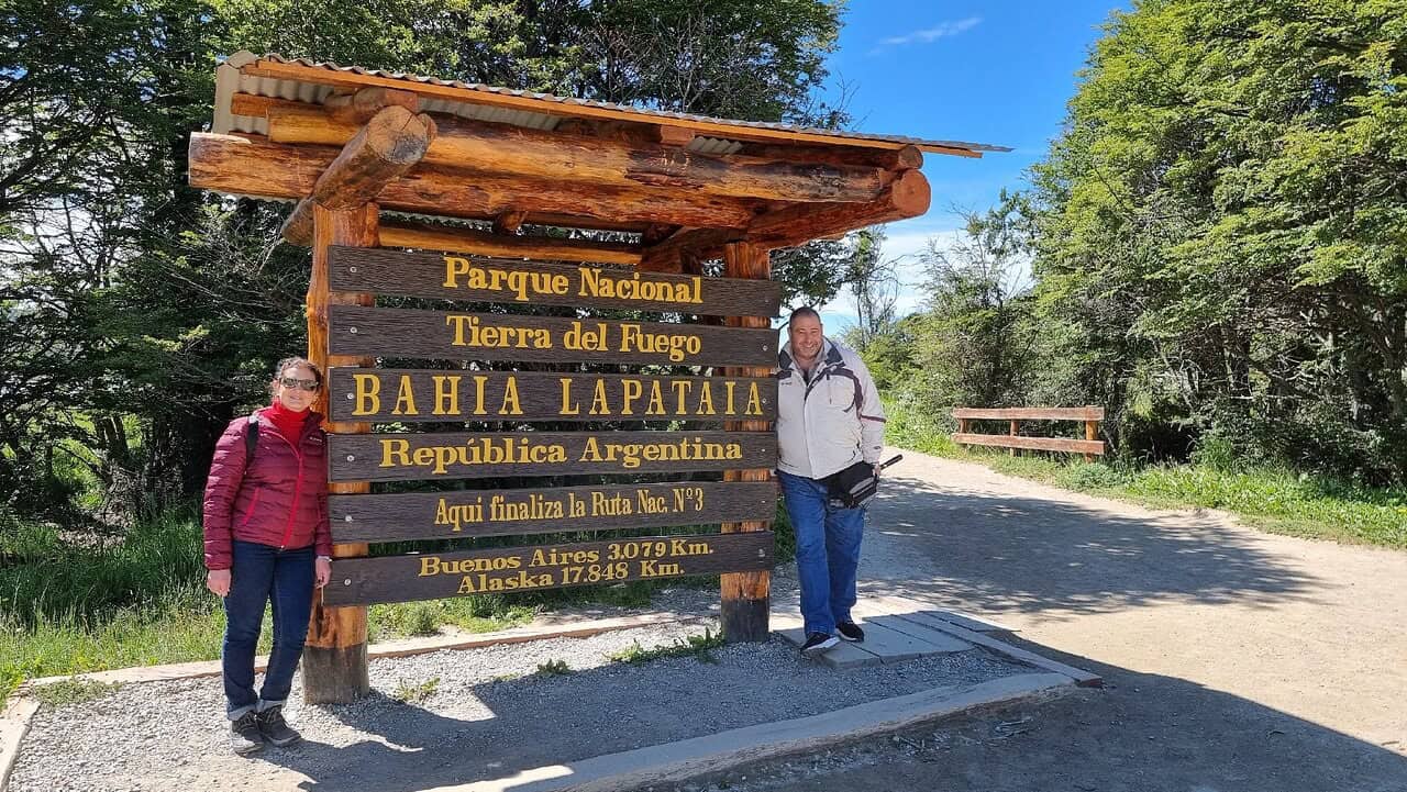
Tierra del Fuego National Park is the only national park in Argentina with a sea coast. That sets it apart from all the others right from the start: it is not just a forest or a mountain or a lake. It is a complete ecosystem where the sub-Antarctic lenga forest reaches the water's edge, where the Beagle Channel can be seen from solid ground between century-old trees, and where National Route 3 — the same road that begins in Buenos Aires 3,079 kilometers away — ends on the shore of Lapataia Bay.
The sub-Antarctic forest ecosystem
The forest surrounding the park's trails is lenga (Nothofagus pumilio), a tree in the southern beech family that in autumn (March-April) turns red and orange in one of the most striking visual spectacles in Patagonia. In spring and summer it keeps an intense green that contrasts with the blue of the sky and the dark gray of the channel. The ñire (Nothofagus antarctica) grows in swampier areas and reaches a lower height. Both species are part of an ecosystem that shares characteristics with the Chilean Valdivian forest and with the southern beech forests of southern South America, Australia and New Zealand — remnants of the supercontinent Gondwana.
This forest is home to the American beaver (Castor canadensis), introduced in 1946 by the Argentine government in the hope of developing a fur industry that never took off. What did take off was the beaver: with no natural predators, the species multiplied to tens of thousands of individuals that today are considered the most serious mammal pest in southern Argentina. Beavers build dams that flood large stretches of forest, killing the trees. Along the park's trails you frequently see the results: dead trees standing in artificial ponds formed by dams of branches and mud. It is enormous environmental damage, but visually it creates a strangely striking landscape — the bleached trunks in the water have something of a natural sculpture.
The must-see points of interest
Ensenada Bay is the first stop and one of the most photogenic: a small sheltered bay where the lenga forest reaches the water's edge and where, on calm days, the reflection of the Andes appears on the surface of the channel. There is a wooden pier from which you can look out over the channel and, with luck, spot a steamer duck (Tachyeres pteneres) — a flightless duck species endemic to Tierra del Fuego and Chilean Patagonia.
The End of the World Post Office is the southernmost post office in the world, from which you can send postcards with the postmark "Ushuaia — End of the World." It may seem a minor tourist detail, but receiving a postcard stamped at the end of the world is one of those experiences the recipient treasures. It operates inside the National Park.
Lake Acigami (also known as Lago Roca) is the most important lake in the park, a mirror of water surrounded by sub-Antarctic forest and snow-capped mountains that on clear days offers one of the most classic views of Tierra del Fuego. The lake is binational: its southern shore belongs to Chile. The name Acigami comes from the Yagan people.
Lapataia River is a short but photogenically powerful river, with dark tea-colored waters from the tannin of the trees, wooden bridges and a series of lenga-lined trails that end at the bay. It is one of the favorite spots for short walks inside the park.
Lapataia Bay and the BsAs 3079km sign is the final point of the excursion and of National Route 3, the longest highway in Argentina, which begins in the Retiro district of Buenos Aires and ends here, with a wooden sign over the bay marking the distance to the starting point. The sign is one of the most photographed spots in Tierra del Fuego. The bay itself is beautiful: surrounded by forest, with the channel's water threading between the islands and the sound of the wind as the only soundtrack.
The End of the World Train
The End of the World Train is an optional activity that operates inside the National Park. It was originally the steam railway used by the prisoners of the Ushuaia penal colony to haul timber from the forest. Today it runs as a tourist train with restored steam locomotives, covering about 7 km between the park station and the End of the World Station. The ride takes about an hour each way, passing wooden bridges, riverbanks and lenga forest, with commentary on the history of the prison and the original railway.
The cost of the End of the World Train is additional to the excursion: between $75.000 and $95.000 ARS depending on the class chosen. It is not essential for seeing the park's main points, but if the prison's history interests you and you want a different experience inside the park, it is worth including.
⚠️ The Tierra del Fuego National Park entrance fee is paid separately, at the park gate. Official APN rates (2026): $18.000 national residents · $8.000 provincial residents · $12.000 students · $40.000 foreign non-residents. Argentine retirees, children under 6 and people with disabilities enter free. The guided excursion includes hotel pick-up, a bilingual guide and access to all the points mentioned — the NP entrance fee is additional.
Ensenada Bay · End of the World Post Office · Lake Acigami · Lapataia River · Lapataia Bay (BsAs 3079km). Bilingual guide included. NP entrance fee and End of the World Train not included.
💡 Combine Beagle Channel + National Park on the same day: With the National Park excursion in the AM slot (pick-up 7:30, return 13:30) and the Beagle Channel navigation in the PM slot (3:00 PM), you cover Ushuaia's two most important experiences in a single day. It is one of the most recommended combinations for travelers with limited time.
Laguna Esmeralda Trek — The Turquoise Jewel of the Fuegian Andes
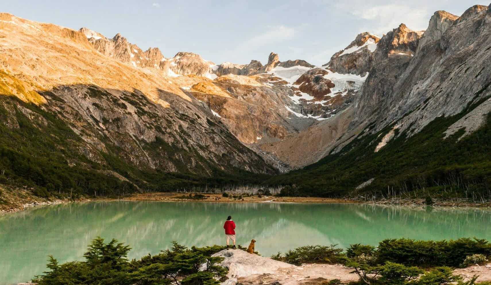
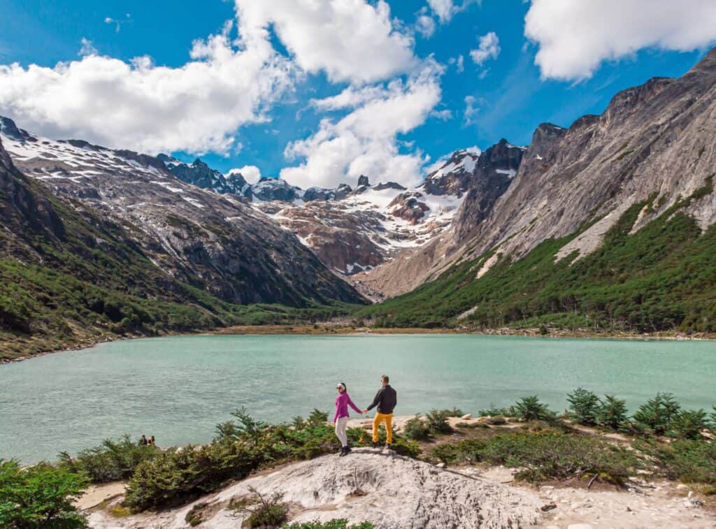
There are destinations that appear in photos and seem exaggerated. Laguna Esmeralda is one of them: when you see it for the first time at the end of the trail, after two hours of hiking through forest and peat bogs, the turquoise color of the water — caused by suspended glacial sediment — looks unreal. It is not a filter, it is not editing. It is the true color of cold water loaded with rock particles ground by ice over centuries.
Why the water is turquoise
The color of Laguna Esmeralda has a precise geological explanation. The water comes from the melt of glaciers and permanent snows of the Fuegian Andes. Over thousands of years, the ice grinds the rock it moves across, producing extremely fine particles called glacial flour or rock flour. These particles, suspended in the water, absorb and reflect light in a particular way: the short wavelengths (blue and green) are the ones that manage to penetrate and be reflected, producing that green-blue that ranges from turquoise to emerald depending on the time of day and the light conditions. It is the same phenomenon that colors the glacial lakes of Chilean Patagonia, the Alps or the Italian Dolomites.
What the trail is like: terrain, real difficulty, what to expect
The route is approximately 14 km round trip with a moderate elevation gain. The trail starts from an access point on National Route 3 and in its first stretch crosses a dense lenga forest, with exposed roots and wet terrain that demands waterproof trekking footwear. This is not optional: the mud can be deep in the first section, especially in spring or after rain.
As you gain altitude, the forest opens up and the trail crosses peat bogs — areas of spongy ground formed by the accumulation of peat moss over centuries. Peat bogs are ecosystems of extremely high ecological value: they act as carbon and water reservoirs and are habitat for various bird species. The trail has wooden planks for crossing them, although in some sectors a plank may be missing and the mud can catch you off guard.
There are several mountain streams to cross along the way, some with small bridges and others crossed by stepping stones. The water is meltwater and extremely cold. In the highest part of the trail, before reaching the lagoon, the landscape opens up completely and you can see the snow-capped Fuegian Andes surrounding the valley where the lagoon sits.
The difficulty is moderate: there are no technical climbs or stretches requiring ropes or specialized equipment, but 14 km on wet mountain terrain over 8 hours does require basic physical fitness and proper footwear. Most people in good physical condition finish it without problems. It is not suitable for children under 8 due to the length and the type of terrain.
The lagoon in winter: snow and silence
One of the most extraordinary experiences Ushuaia offers is the Laguna Esmeralda trek in winter (June-August). The trail appears covered in packed snow, the lenga forest carries branches loaded with white snow, and upon reaching the lagoon the turquoise of the water contrasts with the white of the surroundings in an image few travelers forget. The winter excursion requires warmer clothing and additional precautions, but the guide adapts the route to the conditions. Ask about availability by season.
Includes: mountain guide · trekking poles · box lunch · accident insurance · transfer. Moderate difficulty. Requires waterproof trekking footwear.
4×4 Lakes — Escondido and Fagnano: Off-Road at the End of the World
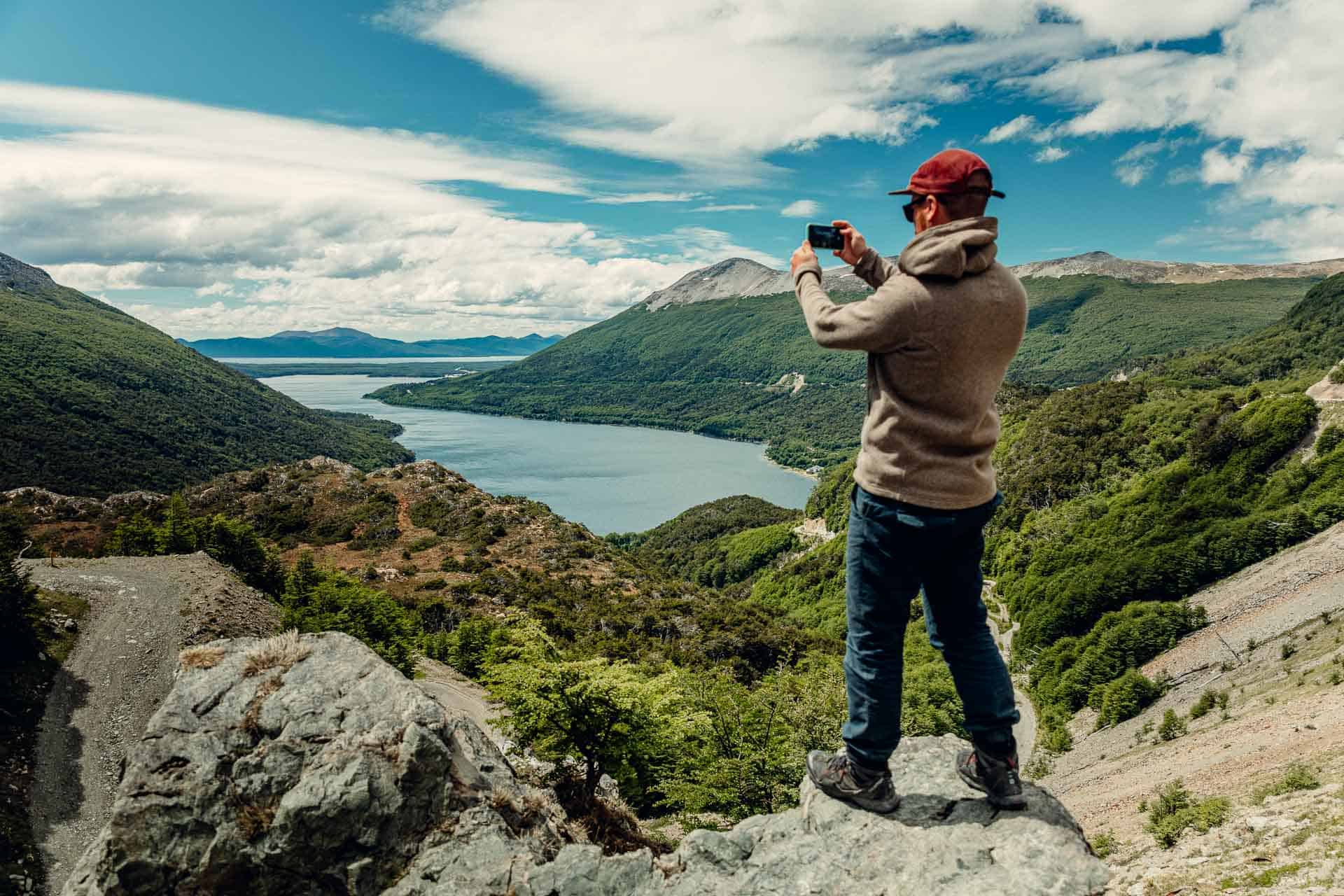
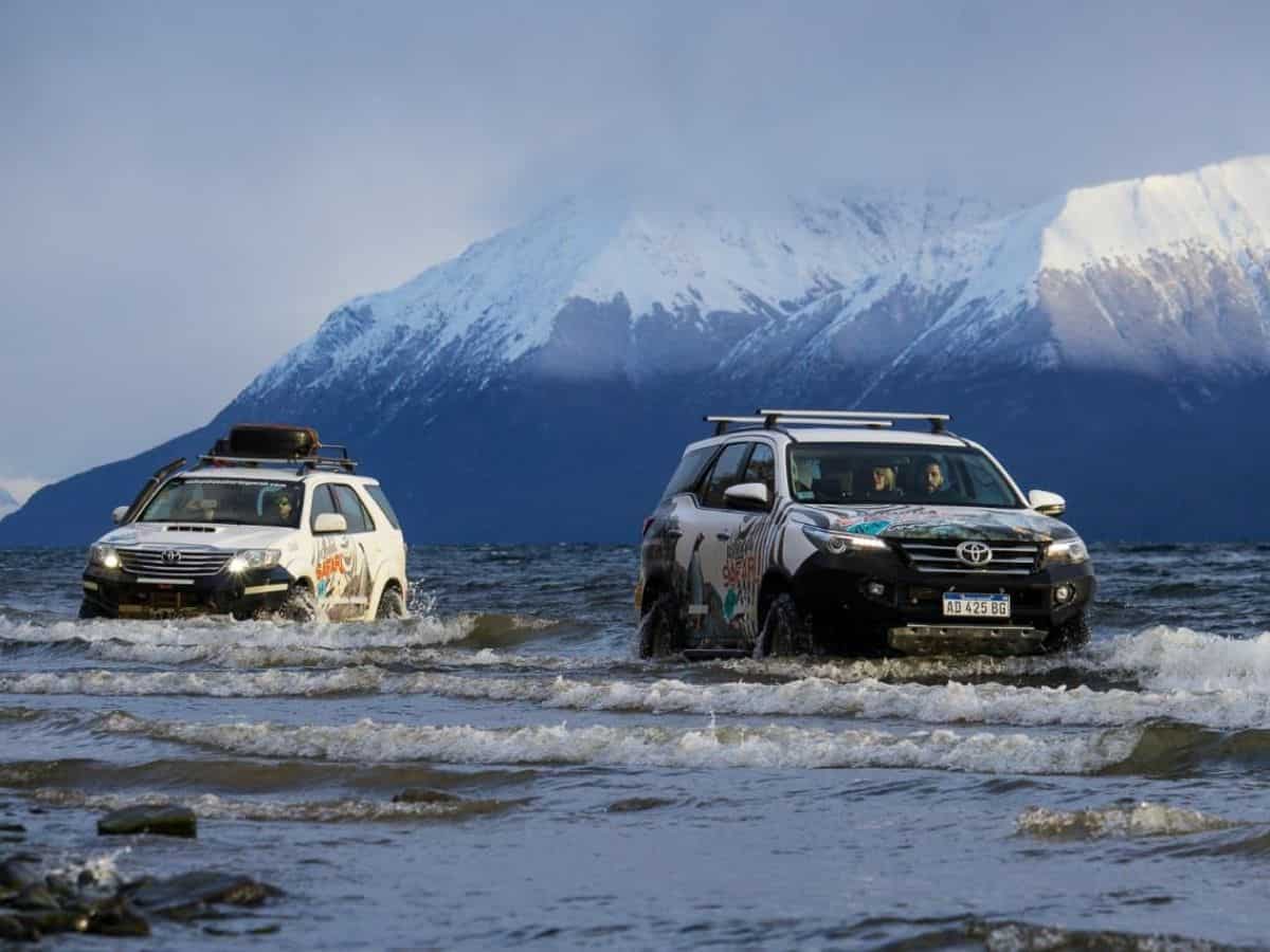
This excursion is the one that most surprises visitors who arrive thinking Ushuaia is only about trekking and boat trips. The proposal is completely different: 4×4 vehicles, dirt tracks, the Garibaldi Pass, and arrival at two of the largest and least visited lakes in Tierra del Fuego. And unlike the trek, it requires no physical effort — it is suitable for all ages and all fitness levels.
The Garibaldi Pass: the secret lookout
The departure from Ushuaia takes National Route 3 heading north and climbs to the Garibaldi Pass, 450 meters above sea level. From there, the panorama is one of the broadest in Tierra del Fuego: to the south you see the Beagle Channel with the Andes sinking into the water, and to the north opens the Lake Fagnano Valley with its gray-blue waters stretching as far as the eye can see. It is a natural lookout few tourists know because it lies off the usual circuits.
Lake Fagnano: 108 kilometers of geological history
Lake Fagnano — known as Lake Kami by the Yagan peoples — is the largest lake in Tierra del Fuego, approximately 108 kilometers long and up to 200 meters deep. What makes it geologically fascinating is its origin: it formed along the Magallanes-Fagnano Fault, one of the region's major tectonic faults, which runs east-west and marks the boundary between the South American plate and the Scotia plate. The lake is literally a scar in the Earth's crust.
The lake is binational: the western shore belongs to Chile and the eastern shore to Argentina, divided by the Oliva boundary marker. Its waters have that characteristic silver-gray color of tectonic-glacial lakes, with small waves that on windy days can be surprisingly violent for an inland lake. On the Argentine shore there are beaches of volcanic stones where the Patagonian wind sounds with a particular intensity.
Lake Escondido: the lake that hides
Lake Escondido lives up to its name ("hidden"): tucked away in the lenga forest and hard to see from the main road. Access requires leaving the asphalt and taking dirt tracks through the forest — hence the need for the 4×4s — until reaching a mirror-forest shore where the water reflects the trees. The experience is far more intimate than Fagnano's: less wind, more silence, and the feeling of being at a lake that still holds something of a secret.
The Fuegian lunch in the countryside
The excursion includes a typical Fuegian lunch in the wild: oven-roasted lamb, homemade bread, regional sides and drinks. Eating in that setting — surrounded by sub-Antarctic forest, with the wind and the silence of Tierra del Fuego in the background — is an experience that by itself justifies the excursion. There are no restaurants in the middle of Lake Fagnano. What you eat here cannot be found anywhere else.
Includes: typical Fuegian lunch · transport in 4×4 vehicles · insurance. Garibaldi Pass · Lake Escondido · Lake Fagnano 108km. Suitable for all ages and fitness levels.
Ushuaia's Historic Quarter — The Prison, the Paseo del Centenario and the Port
After the great natural spaces, Ushuaia also has a compact, walkable historic quarter that holds much of the city's darkest and most fascinating history. It is not a city of imposing architecture — the most interesting buildings are simple, made of wood and corrugated metal — but it does have a density of history per block that few Argentine cities can match.
Maritime Museum and the Prison at the End of the World
This is Ushuaia's most important museum and one of the most interesting in Patagonia. It operates in the original prison building constructed between 1906 and 1920, when the Ushuaia Recidivists' Prison housed political prisoners and common criminals that the Argentine State thought best to place in the most remote spot of its territory.
Among the prison's most famous inmates was Simón Radowitzky, the Russian anarchist who assassinated Buenos Aires police chief Ramón Falcón in 1909 and spent 20 years locked up here before being pardoned. Also imprisoned here was Ricardo Rojas, writer and rector of the University of Buenos Aires, jailed for opposing the government of José Félix Uriburu. The cells are staged with life-size figures, recreations of everyday living spaces and documentation of the cases in each wing.
The museum's naval section documents the history of southern navigation from the first European navigators (Magellan, 1520; Drake, 1578; Beagle, 1830-1836) to modern Antarctic expeditions. There are models of historic ships, original navigation instruments and a section devoted to the shipwrecks of the Beagle Channel and the Drake Passage, which for centuries was the most dangerous stretch of any ocean route.
Allow at least 2 hours to tour the museum at a relaxed pace. If the prisoners' history interests you, you can stay longer. The building itself — with its radial cell blocks, inner courtyards and stone corridors — is impressive.
Paseo del Centenario and Avenida San Martín
The Paseo del Centenario is Ushuaia's waterfront promenade, running along the Beagle Channel with views of the Chilean mountains across the water. In summer it is the favorite spot for locals and tourists to walk at sunset, with the sailboats anchored in the port as a backdrop. Avenida San Martín, parallel and one block north, is the main shopping street: mountain-gear shops, chocolate shops, travel bookstores, restaurants and cafés.
Cerro Martial: the lookout over the city
Cerro Martial is the natural viewpoint closest to the city, about 7 km from downtown along the same road. There are two ways up: by chairlift (which covers the steepest part) or on foot from the base of the hill on a trail of about 2 hours one way. From the top there are splendid views over the city of Ushuaia, the Beagle Channel and the Chilean mountains. In winter the hill has cross-country ski trails and a few minor alpine ski sectors. In summer it serves as the starting point for hikes toward the Martial Glacier, a retreating glacier whose first traces are reached from the top of the chairlift.
The Tourist Port
Ushuaia's port leads a double life: one day Antarctic expedition cruise ships flying the flags of Norway, Germany, the United States and Australia pass through, and the next the tourists from the big circumnavigation cruises come ashore. Port activity in high season is constant and visible from the waterfront promenade. Some travelers take the chance to visit the boarding terminal and see up close the Antarctic expedition ships, which sail from Ushuaia between November and March bound for the white continent.
Additional Activities by Season
🐧 Estancia Harberton and the penguins of Martillo Island (October-March)
Estancia Harberton is the oldest ranch in Tierra del Fuego, founded in 1886 by the Anglican missionary Thomas Bridges, who also compiled the first dictionary of the Yagan language. The estancia is about 85 km from Ushuaia via Route J, and it combines history, nature and marine wildlife in a full-day outing that many consider the best in Ushuaia for those with time.
From the estancia, boats depart for Martillo Island, home to the penguin colony most accessible from Ushuaia. The dominant species is the Magellanic penguin (Spheniscus magellanicus), which arrives at the island in October to nest and leaves in March. In recent years a small colony of rockhopper penguins (Eudyptes chrysocome) has also settled in — locals call them "macaroni" and they are a rarity in the region. The colony has several thousand individuals and access is on foot, a short distance from the nests, with guides who make sure the experience is not invasive.
⛷️ Cerro Castor: the world's southernmost skiing (June-September)
26 km from Ushuaia along National Route 3, Cerro Castor is the southernmost ski resort in the world, with runs ranging from 700 to 1,050 meters above sea level. The season runs from June to September, with peak snow in July and August. It has 32 alpine ski runs of varying levels, a ski school, equipment rentals and a cross-country and snowshoe area for those who prefer snow without speed. Fresh-snow days at Cerro Castor are spectacular: the snow-covered lenga forest, the silence and the views of the Beagle Channel from the upper runs are a combination hard to beat.
🧊 Martial Glacier
The Martial Glacier is the glacier closest to the city and the most accessible in Tierra del Fuego. It sits on Cerro Martial, about 7 km from downtown, and can be reached on foot from the base of the hill in about a 3-hour hike one way. In summer the glacier is in clear retreat — like every glacier in the world — but its blue ice walls and the permanent snow surrounding it offer a unique perspective on visible climate change. No guide is required to approach its outer edges, although climbing onto the ice requires equipment and a specialized guide.
🌲 Free hiking in the Fuegian forest
Beyond the organized excursions, Ushuaia has several freely accessible trails that can be done without a guide. The best known is the Hito XXIV Trail, which skirts Lake Acigami inside the National Park. Outside the park, there are trails around Cerro Martial and some short routes that start at the edge of the city and head into the forest. The key is to always carry water, warm clothing and some rain protection: the weather changes fast.
Free things to do in Ushuaia
The End of the World can also be enjoyed without spending. These plans are free or low-cost, ideal for your arrival day, the afternoon of your departure, or to balance the budget between excursions:
Save the Paseo del Centenario for a clear day and go at sunset: the light over the Beagle Channel and the mountains gives you some of the best photos you'll take in Ushuaia — and it costs nothing.
Comparison Table: Mundo Austral's 4 Excursions
To help you plan which one to do first, which ones to combine and which best suits your group, this table summarizes Mundo Austral's 4 main excursions in Ushuaia.
| Excursion | Duration | Price ARS | Difficulty | Pick-up | Min. age |
|---|---|---|---|---|---|
| 🚢 Beagle Channel | 3 hrs | $90.000 | Low | ❌ | All |
| 🌲 Tierra del Fuego NP | 5 hrs | $90.000 | Low | ✅ | All |
| 🥾 Laguna Esmeralda | 8 hrs | $140.000 | Moderate | ✅ | 8 years |
| 🚙 4×4 Lakes | 8 hrs | $120.000 | No effort | ✅ | All |
💡 Best combination for 4 days: Day 1 → Beagle Channel AM + National Park PM / Day 2 → Laguna Esmeralda (full day) / Day 3 → 4×4 Lakes (full day) / Day 4 → Maritime Museum + Historic quarter + Cerro Martial. With this order you arrive well rested at the most demanding excursions.
Practical Tips for Planning Your Trip to Ushuaia
How many days do you need?
The answer depends on what you want to do, but as a general reference: with 3 full days you can do the Beagle Channel, the National Park and the Maritime Museum comfortably. With 4 to 5 days you add Laguna Esmeralda and the 4×4 Lakes without rushing. With 6 or more days you have room for Estancia Harberton, free hiking and exploring the historic quarter in depth. In winter, if you add skiing at Cerro Castor, allow at least 4 days just for the snow plus the nature excursions that operate year-round.
What should you book in advance?
In high season (December-February), Laguna Esmeralda and the 4×4 Lakes can fill up several days in advance. The Beagle Channel and the National Park have more capacity. If you travel in that period, book at least 48-72 hours ahead. In shoulder season (October-November and March-April) less lead time is needed, but it is always wise to book the day before or first thing in the morning to get the schedules that suit you best.
Weather and clothing by season
Temperatures from 5°C to 15°C. Very long days (20+ hours of light). It can feel warm at midday but the wind lowers the perceived temperature. Bring layers, a windbreaker, high-SPF sunscreen and sunglasses. Rain is possible any day.
The most photogenic time: the lengas turn red and orange. Temperatures between 0°C and 10°C. Fewer tourists, more affordable prices. Autumn in Ushuaia is one of the best times to visit if you have flexible dates.
Temperatures from -5°C to 5°C. Snow in the city and on all mountain excursions. Cerro Castor in operation. Laguna Esmeralda is done in the snow — a different and very special experience. Thermal clothing and waterproof footwear are essential.
The first penguins arrive at Martillo Island in October. The lenga forest begins to turn green again. Changeable weather with the chance of late snow in the mountains. It is the season of the year's first buds and the return of migratory birds to the channel.
Regardless of the season, always bring: waterproof clothing (rain or snow), water-resistant footwear, a warm layer, hat and gloves. Ushuaia's weather can change in minutes: sun, rain, wind and snow in the same day.
The main operators accept cards. There are ATMs in the city. For National Park entrance payments, it is best to carry cash. Prices in pesos are very affordable for tourists with dollars or euros.
How to get to Ushuaia
Ushuaia has an international airport (Malvinas Argentinas Airport, IATA code: USH), with direct flights from Buenos Aires (Ezeiza and Aeroparque) on Aerolíneas Argentinas and LATAM. The flight takes between 3 and 3.5 hours. There are also direct or connecting flights from El Calafate. From the airport to the city center it is 4 km, covered by taxi, remis or transfer.
Overland from El Calafate it is roughly a 12-14 hour trip, with a border crossing into Chile, passage across the Strait of Magellan and re-entry into Argentina through the north of Tierra del Fuego. It is a route some travelers do by bus as part of a circuit, but it is not the most practical access if time is limited.
Book your excursions in Ushuaia
More than 25 years taking travelers to the End of the World. Daily departures, instant confirmation.
More Excursions in Ushuaia — Experiences for Every Taste and Season
Beyond Mundo Austral's four main excursions, Ushuaia has a range of activities that extends to every corner of the Fuegian territory and every season of the year. From the southernmost penguin colony on the planet to snowmobiles in the middle of the snow-covered mountains, these experiences broaden the map of what can be done at the end of the world. Some are for summer, others for winter; some demand physical fitness, others are suitable for babies and older adults. What they all have in common is that they exist only here.
Penguins on Martillo Island — Beagle Channel Navigation
Few experiences in nature compare to walking through an active penguin colony. You do not see them through glass, you do not see them from afar with binoculars: you walk among them, meters from the nests, while the penguins carry on with their routine completely indifferent to your presence. That is what the Martillo Island excursion offers in its landing version.
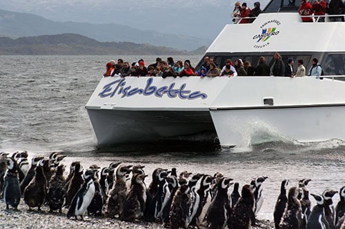
The navigation departs from the port of Ushuaia and covers the Beagle Channel with the same stops as the standard excursion: Isla de los Pájaros with its colony of imperial cormorants — a species that exists only in this region of the planet —, Isla de los Lobos, where a permanent colony of fur seals turns every rocky outcrop into a tangle of bodies, and the Les Éclaireurs Lighthouse, that red-and-white tower rising from a rock in the middle of the channel with the snow-capped Andes behind it. Along the way, the guide tells the story of the SS Monte Cervantes: the German ocean liner that in January 1930 struck a shoal in the Beagle Channel during a pleasure cruise, sank with 2,500 passengers aboard — all rescued — and left Captain Theodor Dreyer, who chose to remain on the bridge, as the only fatality. The ship's remains still lie at the bottom of the channel.
Then comes what sets this excursion apart from the standard navigation: the landing on Martillo Island. The island hosts a mixed colony of Magellanic (Spheniscus magellanicus) and Gentoo (Pygoscelis papua) penguins, a combination found in very few places in the world. Gentoo penguins are larger, more visually striking and behave slightly differently. The walk among them lasts approximately 45 minutes with a guide who explains the biology and behavior of each species.
The shorter version — no landing, navigation only — lets you see the island and the colony from the catamaran. It is an equally valid option for babies, older adults or people with reduced mobility who want to enjoy the Beagle Channel without the demands of the landing. Both versions offer the same visual richness in the channel; what changes is the intensity of the contact with the penguins.
The penguins arrive at Martillo Island starting in October and leave in March. If you travel in winter, you will see the channel's wildlife (sea lions, cormorants) but not the penguins. The mixed Magellanic-Gentoo colony of Martillo Island is one of the few on the planet — most mixed colonies are on the sub-Antarctic islands of the South Atlantic, nowhere near as accessible as this one.
Isla de Pájaros · Isla de los Lobos · Les Éclaireurs Lighthouse · Story of the SS Monte Cervantes · Mixed colony of Magellanic and Gentoo penguins on Martillo Island. Landing version includes a walk among the penguins.
Puerto Almanza and the King Crab Route
To understand what it means to eat king crab in Ushuaia, you have to go to Puerto Almanza. Not the downtown restaurant, not the hotel. You have to drive the 40 kilometers along National Route 3 and then take Provincial Route J — an intermittent gravel-and-asphalt road that skirts the Beagle Channel between lenga forests and historic estancias — until you reach the southernmost fishing village in Argentina. Then, yes.
The excursion begins before reaching the port, with a stop at Laguna Victoria, a mirror of water at the edge of the sub-Antarctic forest with a history that goes far beyond the postcard: it was a living site of the Yagan communities, the people who inhabited the Beagle Channel for thousands of years before the Europeans arrived. The guide — a native of the region, with first-hand knowledge of the territory and its history — explains that context while the forest and the lake do the rest. It is not a fact on a museum plaque. It is a living place with a history still present in the land.
Then comes the Estancias Route: a drive along Tierra del Fuego's back roads that crosses historic properties, opens views toward the channel and the mountains and leads into the heart of rural Fuegian Patagonia — a version of Tierra del Fuego most tourists never see because they never leave the main circuits.
Lunch in Puerto Almanza is the central experience: three courses of fresh king crab pulled that morning from the Beagle Channel, served at the very port the boats sailed from. The king crab (Lithodes santolla) is the most prized crustacean of the continent's far south, and there is a substantial difference between the king crab served here and what you get anywhere else: here the distance between the water and the plate is measured in meters, not days. The setting — the boats in the port, the channel, the clean cold of the Patagonian wind — completes a gastronomic experience that is also a geographic one.
Laguna Victoria has indigenous history — it was a living site of the Yagan communities that inhabited the channel for thousands of years before colonization. The native guide tells it first-hand: not as a fact from a book but as part of a territory he has known since childhood. It is one of those moments of the excursion that stays with you after the taste of the king crab has faded.
Laguna Victoria (Yagan site) · Estancias Route · Puerto Almanza (Argentina's southernmost fishing village) · 3-course lunch with fresh king crab from the Beagle Channel. Native local guide.
Vinciguerra Glacier Trek — All the Way to the Real Ice
If Laguna Esmeralda is Ushuaia's most popular mountain trek, the Vinciguerra Glacier is its version for those who want more: more effort, more altitude, more remote terrain, and at the end of the trail something the Esmeralda does not have — the real ice of the glacier, with its blue crevasses, its seracs and the sensation of standing on a body of ice that has been forming meter by meter in the Fuegian Andes for hundreds of years.
The route begins in the Andorra Valley, one of the most accessible glacial valleys in the Fuegian mountains, and from there climbs over 12 total kilometers through three distinct ecosystems. First the closed lenga forest, with its exposed roots and wet ground that forces you to watch every step. Then the open peat bogs, those ecosystems of moss accumulated over centuries that serve as bird habitat and carbon reservoirs, with wooden planks laid down to keep you from sinking. And finally the high-mountain landscape: no trees, bare rock and permanent snow beginning to appear among the peaks surrounding the valley.
Before reaching the glacier, the trail arrives at Laguna de los Témpanos: a high-mountain lake where small blocks of ice calved from the glacier front float. The scene is extraordinary — chunks of translucent blue ice, some the size of a table, floating in silence on water that reflects the snowy peaks. It is not the kind of image you expect to find a few hours from a city. It is the image most people associate with deep Patagonia, not with a day trip from Ushuaia.
The final point is the front of the Vinciguerra Glacier itself: ice walls several meters high with the blue veins characteristic of ice compressed under its own weight for years, and the seracs — blocks of ice separated by vertical crevasses — that make this glacier a genuine mountain experience. The difference from viewing a glacier from afar or from a lookout is total: you are at the foot of the ice, you hear it creak, you feel the cold radiating off it. It is a high-mountain experience that in many parts of the world requires technical equipment; here, with a guide and the right gear, it is within reach of anyone in good physical condition.
⚠️ High difficulty. Only suitable for people aged 15 to 55 with mountain trekking experience and very good physical condition. Not suitable for people with heart or knee problems or vertigo. Requires mid/high-cut trekking boots with good grip, gaiters and a waterproof jacket. Not recommended on days of heavy rain or fresh snow without the guide's go-ahead.
Andorra Valley · Sub-Antarctic forest · Peat bogs · Laguna de los Témpanos · Vinciguerra Glacier with blue crevasses and seracs. 12km of trekking. Only ages 15 to 55 in very good physical condition.
Cabo San Pablo and Estancia Pirinaica — The Desdémona Shipwreck
This is Ushuaia's longest excursion — twelve hours, a full day — and the only one that reaches the Fuegian Atlantic coast, at an end of the island that looks very little like the Ushuaia of the tourist catalogs. There are no snow-capped mountains reflected in the channel. There is steppe, wind, guanacos, condors and the rusted hull of the ship Desdémona stranded on the coast since 1980. It is Tierra del Fuego at its rawest and freest.
The excursion begins with breakfast at Estancia Pirinaica, a ranch with nearly a hundred years of history on the outskirts of Ushuaia, on the way to Tolhuin. A country breakfast at a Patagonian estancia has its own timing and its own rhythm: it is not a hotel breakfast. It is the first meal of the day with the silence of the Fuegian pampa in the background, before the road begins to open toward the east of the island.
The route continues along the Estancias Route toward Lake Fagnano and then turns north and east, crossing a landscape that gradually shifts from forest to steppe and has in the Garibaldi Pass one of its most photographic moments. As the terrain opens up and the forest falls behind, the first guanacos begin to appear — in groups of ten, twenty, sometimes fifty animals grazing on the hillsides — and red foxes crossing the road without hurry. In the sky, if the day cooperates, Andean condors ride the air currents with that nearly three-meter wingspan that makes them unmistakable.
The San Pablo Lighthouse is one of the most singular images of the entire excursion: famous in the photography world for leaning noticeably to one side, the result of Patagonian erosion that undermined the base of its structure over decades. There is no other lighthouse like it on the planet. The combination of the tilted lighthouse, the Patagonian sky and the Atlantic coast makes this one of those places that justify the memory of a trip.
But the central image of Cabo San Pablo is another one: the ship Desdémona. In September 1980, during a storm with the kind of winds the Fuegian Atlantic coast can generate without warning, the cargo ship Desdémona lost control and ran aground on the stones of the beach. The attempt to refloat her failed. The years that followed did what the sea always does with the things left to it: rusted her, split her open, covered her in algae and turned her into something that is no longer a ship but an installation in the landscape. Today the hull of the Desdémona is one of the most photographed sites in Tierra del Fuego, although very few tourists know it exists.
Lunch is at the Casa del Pescador, with fresh Patagonian sea bass and seafood empanadas that come from the same sea visible from the tables. The close of the excursion has that particular quality of long days in the south: coming back with twelve hours of landscape accumulated and the feeling of having seen a Tierra del Fuego that exists beyond all the end-of-the-world signs.
The ship Desdémona ran aground in 1980 on the coast of Cabo San Pablo during a storm. Since then, the sea and the wind have been turning her into a natural sculptural installation. It is one of the most iconic and least known postcards of Tierra del Fuego — most tourists who look it up on Google find it and wonder how they never knew it existed.
Estancia Pirinaica (breakfast) · Estancias Route · San Pablo Lighthouse (leaning) · Desdémona shipwreck (1980) · Casa del Pescador (lunch with fresh sea bass). Guanacos, foxes, condors. Fuegian Atlantic coast.
Full Day Snow — Tierra Mayor Valley (winter only)
If there is one excursion that defines what it means to visit Ushuaia in winter, it is this one. It is not a snow activity: it is five snow activities in a single day, in one of the snowiest valleys of Argentine Patagonia, on a route that includes modes of transport that only exist when the snow is more than a meter deep.
The Tierra Mayor Valley is 36 kilometers from Ushuaia along National Route 3. In winter season it accumulates between one and two meters of packed snow that completely close off parts of the valley to conventional vehicle traffic. To reach those areas, the only possible means is the snowcat: a tracked machine designed to move over deep snow without sinking, which carries the group through sectors of the valley completely inaccessible any other way. The snowcat crossing is not just a means of transport — it is an experience in itself, with the crunch of the snow under the tracks, the cold slipping in through every gap and the white landscape opening on both sides without another visible trace of humanity.
The day also includes snowshoeing through the snow-covered forest: the lengas with their snow-laden branches create a landscape that in some stretches looks more like Lapland than Patagonia. The forest in silence, with only the sound of the wind and of footsteps on the snow, is one of those moments you cannot find anywhere else in the world less than three hours' flight from Buenos Aires.
The husky sled ride (mushing) is, for many, the high point of the day. There is something about the experience of riding a sled pulled by a team of huskies that has no rational equivalent — the speed, the sound of paws on the snow, the dogs panting and running with an energy that seems superhuman. It is the kind of activity kids never forget, and neither do the adults. The snowmobiles add the adrenaline of an engine over the white of the valley.
Lunch is at the Refugio del Hachero, a heated dome in the middle of the snowy valley serving hot food while outside the wind blows and the temperature can sit several degrees below zero. The contrast between the cold outside and the warmth of the refuge — with the steam of the stew and the hot chocolate — is as Fuegian as the penguins or the Beagle Channel.
The Tierra Mayor Valley accumulates between 1 and 2 meters of snow in season. The snowcat is the only way to reach parts of the valley that are completely blocked off in winter. It is an experience with no summer equivalent — in December, that same valley is full of vegetation and gives no hint of what it was in July.
5 activities in 1 day: snowshoeing · snowcat · husky sled ride · snowmobiles · hot lunch in a heated dome (Refugio del Hachero). Tierra Mayor Valley, 36km from Ushuaia. Ushuaia's most complete winter excursion.
White Adventure — Sleds and Snowmobiles (winter only)
Not every traveler has a full day available for the Tierra Mayor Valley. For those seeking the adrenaline of the snow in a more compact format — and more accessible for groups with small children or adults who prefer something less intense — the White Adventure offers the two most iconic activities of the Ushuaian winter in six hours: husky sledding and snowmobiles.
The mushing — a sled pulled by husky dogs — covers a two-kilometer circuit through the snow-covered forest. Huskies are animals trained for this from puppyhood, with an energy and a resistance to cold that make them perfect for the Fuegian winter. The experience of standing or sitting on the sled while the dog team launches itself between the trees has something of a fairy tale and something of real adrenaline — the dogs do not run slowly. The guide accompanies the ride and explains the history of mushing in the region, which in Tierra del Fuego has roots in the first polar explorers who used sled dogs for Antarctic expeditions.
The snowmobiles cover a five-kilometer circuit through the open valley, where visibility extends to the peaks of the mountain range. No prior experience is required — the guide gives instructions before the ride and the circuit is designed so anyone without experience can handle it safely. The difference in sensation between driving a snowmobile in the silence of the valley and any other speed activity is total: the white surroundings amplify everything.
The culipatín — sliding down a snow slope on a kind of flat sled — is the most lighthearted activity and also the one that draws the most laughter, especially with the little ones. And the close at the refuge, with hot chocolate and snacks, has that particular flavor that only warm things have after the cold.
💡 If you have to choose between winter and summer in Ushuaia, winter has a completely different atmosphere: the snow-covered city, the white mountains and the chance to go mushing and snowmobiling are experiences exclusive to July-September. The White Adventure is the most accessible version of that Fuegian winter — suitable from ages 8 to 70.
Husky sled ride (2km) · Snowmobiles (5km) · Culipatín sledding · Hot chocolate and snacks at the refuge. A more compact version of the Full Day Snow: the same core adrenaline, a more accessible format. No prior experience required.
Beagle Channel + Landing on Martillo Island — The Complete Version
Of all the experiences combining navigation and land in the Beagle Channel, this is the one that goes furthest in every sense: more hours on the water, more history at each stop, more wildlife on the island, and the landing on Martillo Island with a walk among the penguins that turns a boat trip into a true immersion in the planet's southernmost ecosystem.
The navigation covers the full channel — Isla de los Pájaros, Isla de los Lobos, Les Éclaireurs Lighthouse — but then continues east, following the north shore of the channel until reaching Estancia Harberton. Founded in 1886 by Thomas Bridges, an Anglican missionary who arrived in Tierra del Fuego in the 1860s and devoted decades to documenting the culture and language of the Yagan, Harberton is the oldest private property in Tierra del Fuego. Bridges compiled the first dictionary of the Yagan language — an ethnographic work of a richness still studied today — and built this estancia on the bay he chose as his permanent home. It is run today by his descendants, who have preserved the name and the original structure of the first buildings.
The stop at Harberton has a different texture from any other Ushuaia excursion: you are on private land with nearly one hundred and forty years of history, surrounded by the same trees the Bridges family planted at the end of the 19th century, with the channel behind you and the Chilean mountains on the horizon. There is a cetacean museum at the estancia — with skeletons and remains of whales and dolphins stranded on the coast — and the chance to see the founder's original house.
The final point is Martillo Island and the walk among the penguins. This version includes a landing — visitors step onto the island and walk through the colony with the guide, meters from active nests — which sets it completely apart from the navigation-only version where the island is seen from the catamaran. Standing on the same island as the colony, hearing the noise of thousands of penguins, watching the chicks beside their mothers and the adults coming in from the sea with crops full of fish, is an experience with no precise verbal translation. You have to go.
Estancia Harberton was founded in 1886 by Thomas Bridges, an Anglican missionary who compiled the first dictionary of the Yagan language — a decades-long work documenting a language that today has barely a handful of speakers. It is the oldest private property in Tierra del Fuego and is run today by his descendants. The history told inside Harberton is not in any tourism manual.
Full Beagle Channel navigation · Les Éclaireurs Lighthouse · Isla de Pájaros · Isla de los Lobos · Estancia Harberton (1886, Thomas Bridges) · Landing on Martillo Island · Walk among Magellanic and Gentoo penguins. The most complete version of the Beagle Channel experience.
All Ushuaia Excursions at a Glance
To help you plan what to do and in what order, this table brings together the 11 excursions: Mundo Austral's 4 with their own pages plus the 7 additional ones available on request.
| Excursion | Duration | Price | Season | Difficulty | Pick-up |
|---|---|---|---|---|---|
| 🚢 Beagle Channel — Sea Lions and Lighthouse | 3 hrs | $90.000 | Year-round | Low | ❌ |
| 🌲 Tierra del Fuego NP | 5 hrs | $90.000 | Year-round | Low | ✅ |
| 🥾 Laguna Esmeralda Trek | 8 hrs | $140.000 | Year-round | Moderate | ✅ |
| 🚙 4×4 Lakes | 8 hrs | $120.000 | Year-round | No effort | ✅ |
| 🐧 Martillo Island Penguins — Navigation (coming soon on mundoaustral.com.ar) | 5-8 hrs | from $235.000 | Oct–Mar | Low | ✅ |
| 🦀 Puerto Almanza and King Crab (coming soon on mundoaustral.com.ar) | 8 hrs | from $190.000 | Year-round | No effort | ✅ |
| 🧊 Vinciguerra Glacier Trek (coming soon on mundoaustral.com.ar) | 8 hrs | from $180.000 | Year-round | High | ✅ |
| ⚓ Cabo San Pablo and Desdémona (coming soon on mundoaustral.com.ar) | 12 hrs | from $220.000 | Year-round | Low | ✅ |
| ❄️ Full Day Snow — Tierra Mayor Valley (coming soon on mundoaustral.com.ar) | 8 hrs | from $342.000 | Jul–Sep | Low | ✅ |
| 🛷 White Adventure — Sleds and Snowmobiles (coming soon on mundoaustral.com.ar) | 6 hrs | from $315.000 | Jul–Sep | Easy | ✅ |
| 🐧 Beagle Channel + Landing Martillo Island + Harberton (coming soon on mundoaustral.com.ar) | 8 hrs | Ask | Oct–Mar | Low | ✅ |
Frequently Asked Questions about Things to Do in Ushuaia
The most common questions from travelers planning their trip to Ushuaia.